Get to Know Us
GeoWatSpace is an Omani technology company focused on innovative water and agriculture solutions. By integrating satellite imagery, remote sensing, and artificial intelligence, we provide data-driven insights that enhance water resource management, improve agricultural productivity, and support environmental sustainability.
Our Services
We deliver satellite-based mapping, remote sensing, and AI solutions for smarter water, agriculture, and environmental management.
Water & Agriculture Monitoring
Real-time monitoring of water resources, crops, and land use for smart planning and sustainable resource management..

Remote Sensing & Mapping
Advanced satellite imagery analysis, remote sensing, and digital mapping for water, agricultural, and environmental applications.

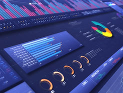
AI & Data-Driven Solutions
AI-driven analytics and geospatial tools that transform data into practical and decision-ready outputs for water and agriculture management.
Meet the Team
Our team at GeoWatSpace brings together experts in satellite imagery, GIS, AI analytics, and drone technology. We combine deep local knowledge of Oman’s water and agriculture systems with cutting-edge technology to deliver innovative, sustainable solutions.

Ammar Al Fahdi
CEO

Hamza Hamed
ML Engineer

Lamees Al Athali
Project Manager

Basma Al Kindi
GIS & RS Specialist

Wasan Al Salhi
AI Developer
Working With the Best Clients and Partners